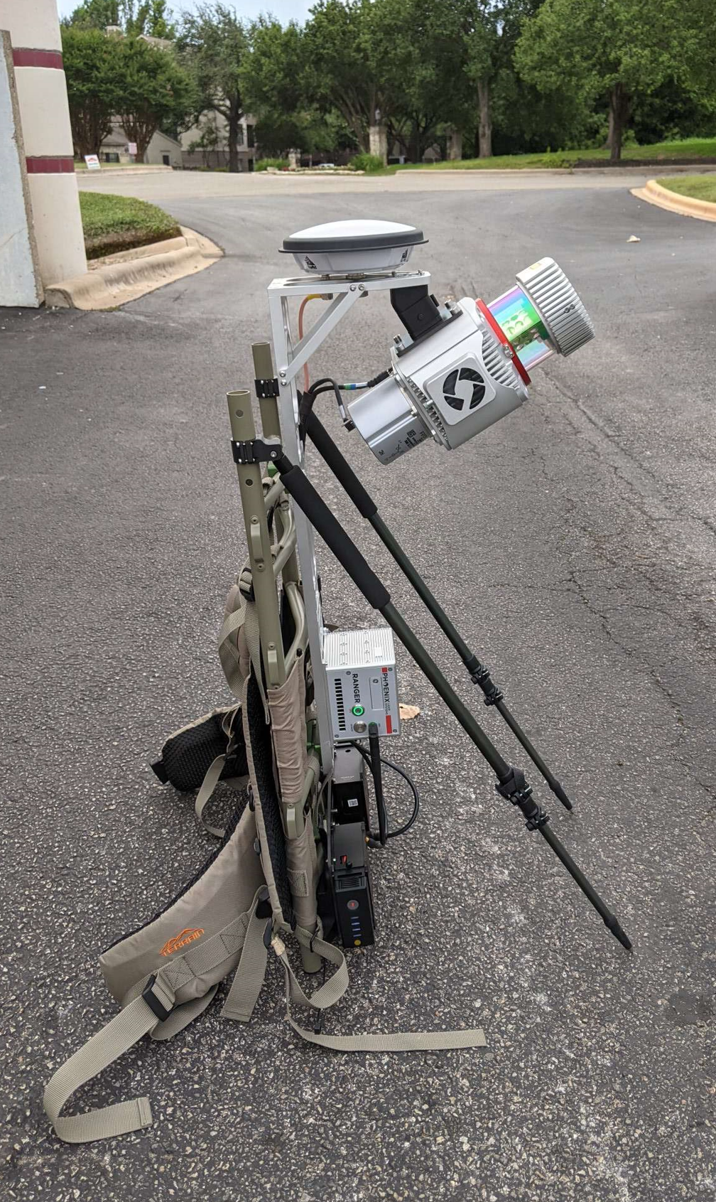
Backpack Acquisition
Backpack data acquisition generally refers to collecting data via backpack platform. This data can then be processed with conventional inertial processing (NavLab, InertialExplorer). If you have a mutli-laser system (RECON-XT, Scout-M2X), then you may opt to process the data using SLAM.
Alignment with Pedestrian Acquisition
Typically the kinematic alignment with an aerial or mobile data set entails travelling in a straight line for about 50 - 100 meters (see INS basics). This is similar for pedestrian acquired data sets.
INS Kinematic Alignment Strategy (All IMUs)
Per Novatel’s Recommendations, the following should be performed in the field for backpack acquisition:
IMPORTANT: Begin and end the backpack survey walking in an area with reasonably open views of the sky.
It is recommended that at least 30 to 40 seconds of data be collected while walking at a constant heading (before and after survey). This will ensure that an initial position, velocity and heading can be determined from the GNSS data, which is required by the alignment process.
Following this initial coarse alignment procedure, several changes in heading (left and right turns) should be performed to maximize attitude convergence prior to entering challenging GNSS conditions.
INS Static Alignment Strategy (FOG IMUs # 32-60)
Collecting stationary data during the alignment is important for Fiber Obtic Gyro (FOG) IMUs as they are capable of static alignment.
Static alignment uses the sensed gravity vector components to estimate roll and pitch. It uses sensed Earth-rotation rate to provide an initial estimate of the yaw of the IMU. As such, only IMUs with gyro biases much less than the Earth rate (15 deg/hr at the equator) are capable of reliable static alignment.
Begin and end the backpack survey with the backpack sitting static in the upright position, with stabilizing poles extended, and in an area with reasonable open views of the sky for 3-5 minutes.

Last updated