Flight Planning
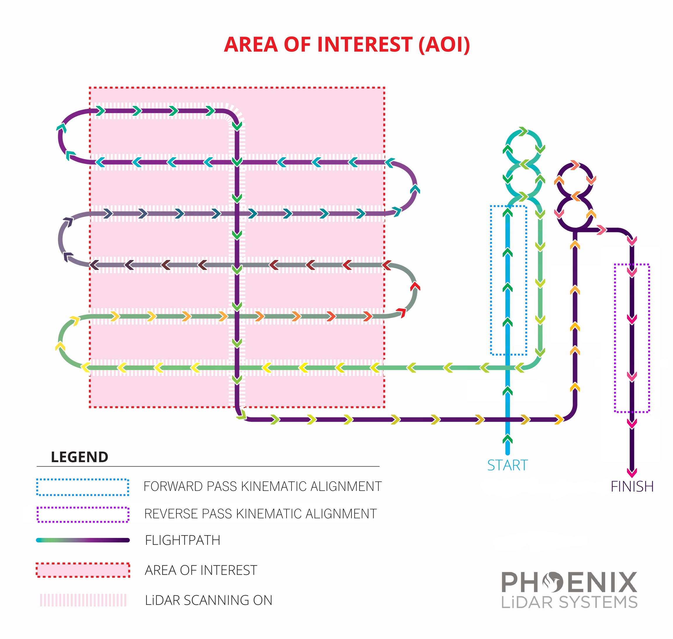
Flight planning is essential to ensuring quality data is being acquired during each mission. A proper flight plan can increase accuracy, reduce acquisition time, reduce processing time/troubleshooting, and make certain that you are achieving full coverage over the area of interest. Phoenix LiDAR Systems' Flight Planner software is the perfect way to effectively and efficiently plan waypoints and to ensure quality data capture.
Preparation for UAS LiDAR acquisition can be broken down into several easy to follow steps:
Defining your Area of Interest (AOI) and requirements for the final deliverable,
Defining the environment (LAANC, Topography, Legality, Meteorology, Etc.); and
Designing your Flight Plan.
Defining your AOI and requirements for final deliverable
The first thing a RPIC should do is either have the AOI defined by the client or define the AOI themselves. Knowing the lateral boundaries of your project will help when defining the environment of your flight plan.
The easiest way to define an AOI is by utilizing a KML to define the boundaries. Google Earth Pro is widely used method to create KMLs without the use of proprietary software's and/or GIS tools.

Once The AOI is defined by the KML, it is time to determine what is the deliverable within the AOI. LiDAR point density is an important requirement to adhere to when flight planning. The American Society for Photogrammetry and Remote Sensing (ASPRS) defines Points per Square Meter (PPSM) as the amount of returns/echo's collected by a LiDAR within a 1-meter by 1-meter area in a single swath pass. So it is important to remember this standard when defining your deliverable.
Knowing the PPSM for your project helps you define the boundaries of your flight plan. Each LiDAR sensor is unique and knowing the limitations of your sensor is paramount to providing quality data as a deliverable. One feature the Riegl LiDAR's offer is a powerful tool called RiParameter.

RiParameter uses the following parameters to determine the LiDAR scan pattern:
Pulse Repetition Rate (PRR),
Scan Rate,
FOV,
Altitude in AGL; and
Speed.
Using these parameters, the user can fine tune their LiDAR acquisition to optimize it to their needs. If your system is not a Riegl, other tools can be used instead. One such tool is the Phoenix LiDAR Systems (PLS) Flight Planner 9.0. Flight Planner can provide similar LiDAR output data as RiParameter for any LiDAR PLS supports.

Defining the Environment
Knowing the Environment you are about to operate in is key to success. If you don't take into account the FAA airspace, the topography, and legality under FAA Part 107 rules, you could delay your acquisition and possibly face legal consequences. Some of the key areas PLS recommends checking prior to flight planning are:
FAA airspace or more specifically LAANC. LAANC is the Low Altitude Authorization and Notification Capability, a collaboration between FAA and Industry. It directly supports UAS integration into the airspace. Knowing when and where a LAANC authorization is needed is paramount during the early stages of your mission planning. LAANC may limit where and how high you can fly, which directly affects the settings on your LiDAR sensor.


using the KML/ KMZ we created earlier, we can go into Google Earth Pro and observe the topography, vegetation, and Line-of-Sight (LOS) issues that may or may not be present. Google Earth Pro has many tools to better understand their environment remotely before ever setting foot on the location.


Knowing your local and Federal laws prior to flying will keep you out of trouble. PLS strongly recommends you stay current with the 14 CFR Part 107 FAA regulations for Drones.

Lastly, weather and meteorological conditions can have a detrimental affect on your LiDAR data. It's recommended to pay close attention to your weather forecast and changing meteorological conditions. Weather can be unpredictable, but a good UAS LiDAR RPIC will maintain situational awareness and be ready to adjust accordingly. It's recommended to use multiple sources of information to make a educated decision in regards to weather. Consider the following useful weather apps below:
Windy and Windy.app
AeroWeather
UAV Forecast
Aloft Air Control
Designing your Flight Plan
PLS offers a suite of options when it comes to flight planning. Applications like RiParameter are available to our customers purchasing Riegl LiDAR units. Flight Planner is also available to all of our customers and is a powerful tool for LiDAR acquisition planning. I recommend going to the Flight planner section of this user manual for further information regarding what PLS offers.
Flight Pattern
The recommended flight pattern is a grid with parallel flight lines that have the right amount of overlap at a constant height over the terrain. Refer to the Mission Type section for more information on our Flight Planning Software.

Flight Speed
The recommended flying speed for optimum data capture via UAV is usually between 6 and 8 ms. Of course this is just a rule of thumb, as factors like desired point density, LiDAR and camera field-of-view, wind conditions, height and flight time restrictions all influence each other.
Point cloud accuracy can decrease with increased vehicle vibrations, so its important to find the right speed to fly so the aircraft always flies smoothly. Navigation system accuracy can also decrease when moving very slowly, because the GNSS/IMU data fusion benefits from observing dynamics in the IMU measurements.
Point Density
There are a few ways to increase point density:
Reduce flight velocity
Decrease AGL (Above Ground Level)
Increase PRR (Pulse Repetition Rate)
Only an option on some miniRanger and Ranger models
We recommend utilizing RIEGL's RiParameter to determine optimal PRR
Increase lateral overlap between flightlines
Increasing Motor RPM (Scout models) can influence point distribution, but will not affect point density
Last updated