Processing Tools
Pipelines
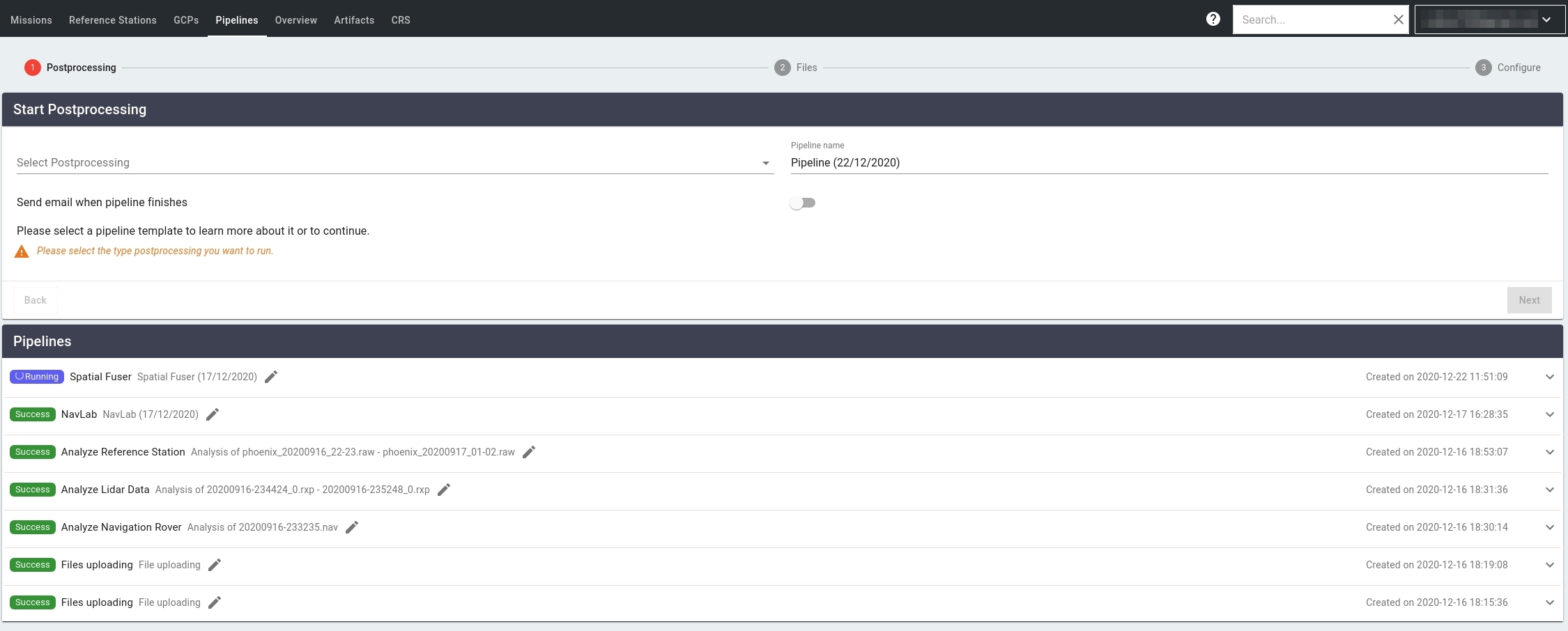
LiDARMill offers numerous data processing tools, called “Pipelines.” There are two types of pipelines, automatically generated pipelines and manual pipelines. Manual pipelines require user input to select from various pipeline parameters.
Automatic Pipelines:
File Uploading - Automatically generated from user uploading files to LiDARMill project. Files include mission data and ground control data
Analyze Navigation Rover - Analyzes GNSS/IMU trajectory information to determine time, duration, and location of mission(s).
Analyze LiDAR Data - Analyzes raw LiDAR data to determine time and duration of LiDAR data collected during the mission(s)
Analyze Reference Station - Analyzes static reference station data, and post processes the data using NOAA's Online Positioning User Service (OPUS) and Trimble's RTX correction service to determine a high accuracy reference station position to be utilized during trajectory post processing.
Manual Pipelines:
Navlab - a series of programs running algorithms designed to post-process your trajectory. It is highly recommended that you run your unprocessed trajectory through NavLab. Doing so will apply both GNSS and IMU corrections to your trajectory.
Spatial Fuser - LiDARMill’s Spatial Fuser Pipeline uses the trajectory data generated by NavLab, combined with LiDAR and Imagery data from your system, to generate a point cloud, DTM, Contours, and other georeferenced data products.

Last updated