Example 2: Dynamic Datum
EXAMPLE 2: Dynamic Horizontal Datum with Geodetic Vertical Datum using RTX Refined Reference Station Coordinates (@ L1 Phase Center)
Data Collected : 06/18/21
Desired output for LAS/LAZ: WGS84 UTM 14 North Meters
Horizontal Datum: WGS84 UTM 14 North Meters
The World Geodetic System 1984 (WGS84) has been revised six times since its original realization in 1987.
The most recent version is WGS84 (G2139) implemented on 3 January 2021 and aligned to the International GNSS Service (IGS) realization of the International Terrestrial Reference Frame 2014 (ITRF2014), known as IGb14.
WGS84 (G2139) will replace (G1762), however, it is not currently available. Until it is, G1762 should be selected.
The WGS84 reference frame is realized globally through the coordinates of 17 DoD monitoring stations distributed across the world.
WGS84 is a dynamic reference frame.
At the beginning of each year, the National Geospatial-Intelligence Agency (NGA) update station coordinates of the 17 sites.
The coordinates are adjusted to an epoch at the half year mark to account for plate tectonic motion.
This means that WGS84 coordinates derived by users from GPS measurements will appear to move over time.
WGS84 = Datum
(G1762) = Realization
2021.46 = Date of acquisition = Epoch
UTM 14 North = Map Projection
Meters = Units
Vertical Datum: WGS84 (G1762)
WGS84 is a geodetic vertical datum and does not require the user to select a geoid model.
Navlab and LiDARMill Workflow
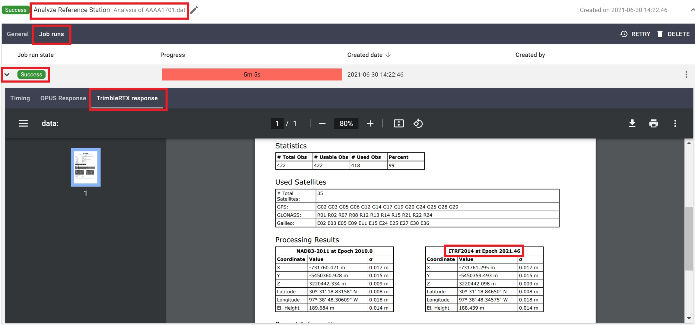
LiDARMill does not require the user input of the epoch when RTX refined reference station coordinates are utilized, because it extracts the epoch from the RTX report.
Project CRS Georeferencing
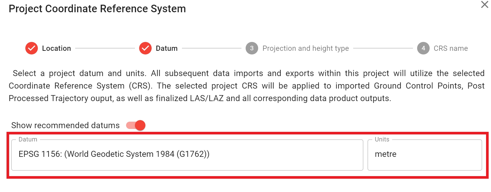
During project creation, select "WGS84 (G1762)" as the project datum and select "Metre" for the project units.
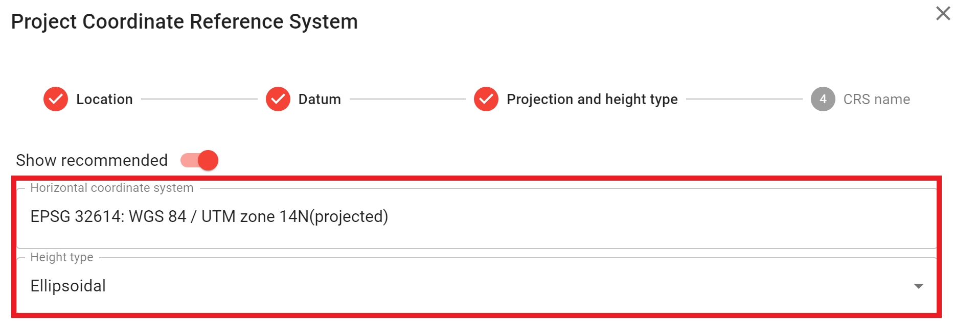
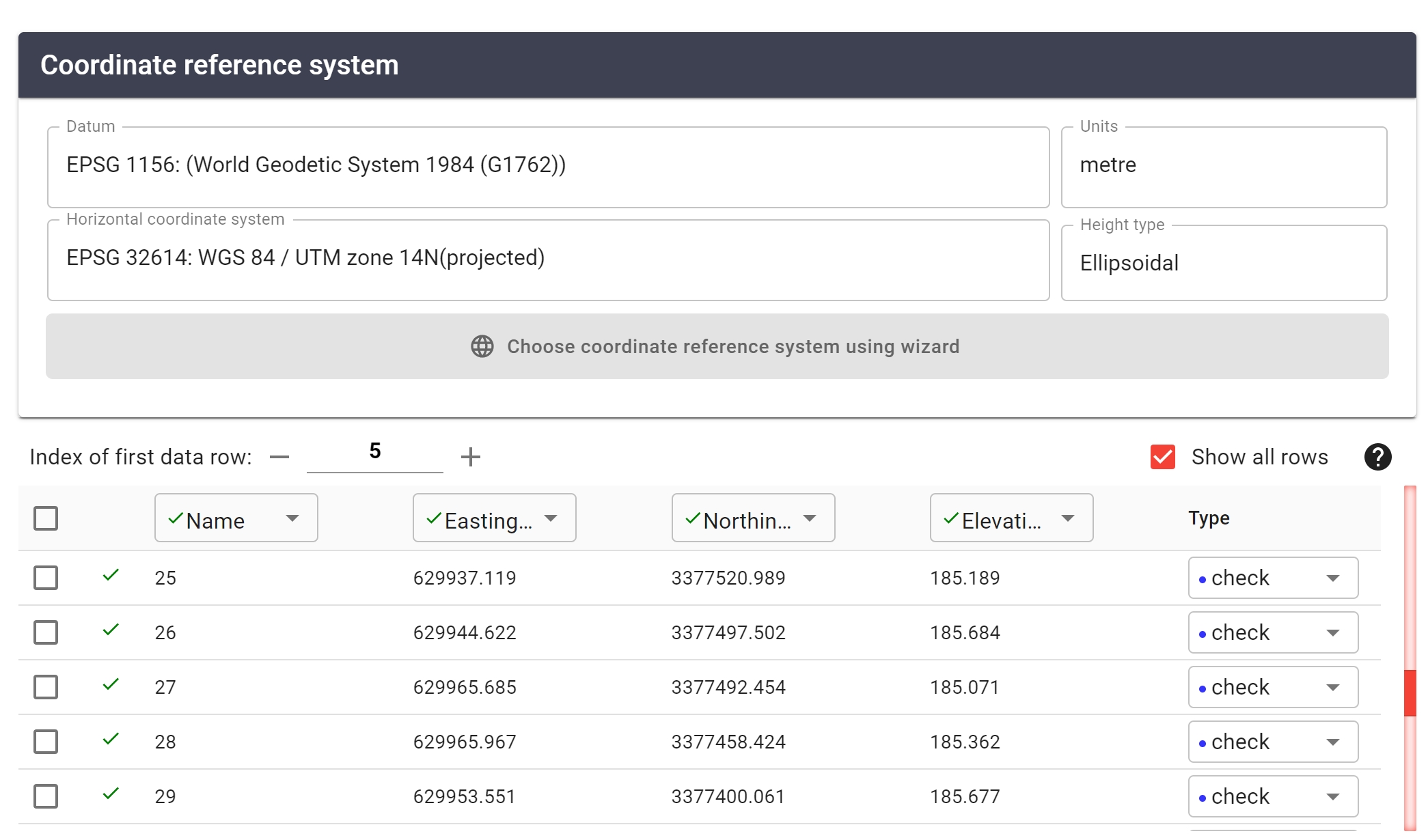
Next, select the Horizontal coordinate system "WGS84/UTM zone 14N" (Datum and Map Projection) and "Ellipsoidal" as the vertical geodetic coordinate system (WGS84(G1762) will be automatically selected for vertical CRS)
GCP Georeferencing
The project CRS should match the GCP CRS. You can verify the GCP CRS by clicking on the "GCP" tab within LiDARMill, and then clicking the button to the right of the GCP artifact, then click "Edit artifact"
Reference Station Georeferencing
In step two of a Navlab Pipeline, select the ITRF2014 refined trajectory. Navlab will automatically specify the epoch (derived from the RTX report).

Output Trajectory Georeferencing
In step three of a Navlab Pipeline, select the output datum as ITRF 2014

Export Pointcloud Georeferencing
LiDARMill may prompt the user to select the output coordinate system within the Spatial Fuser Pipeline. If it does not prompt the user, the Project CRS will be used.

Inertial Explorer and Spatial Explorer Workflow
Project CRS Georeferencing
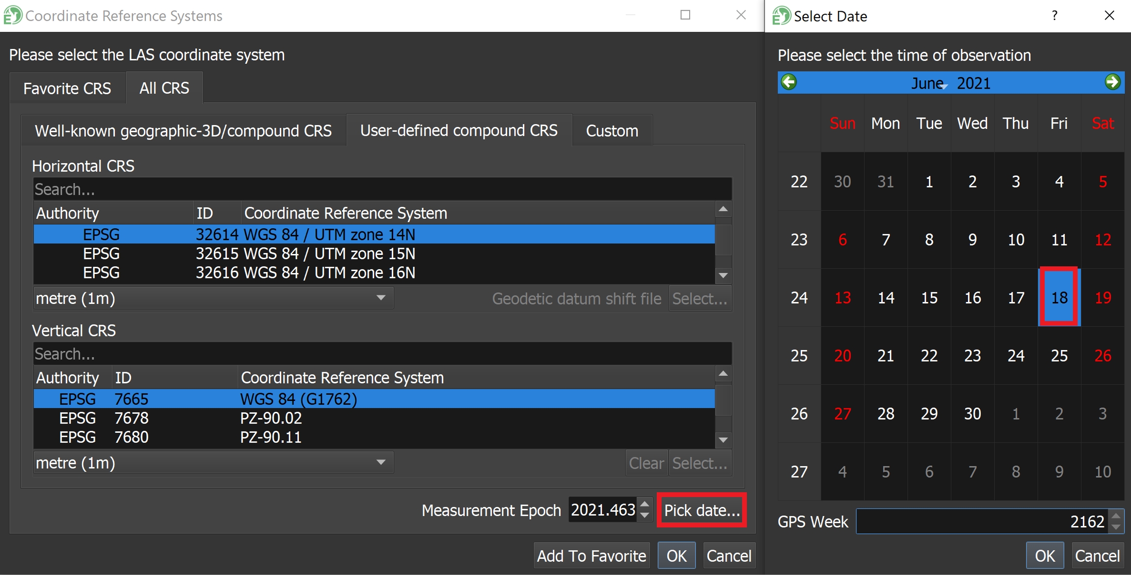
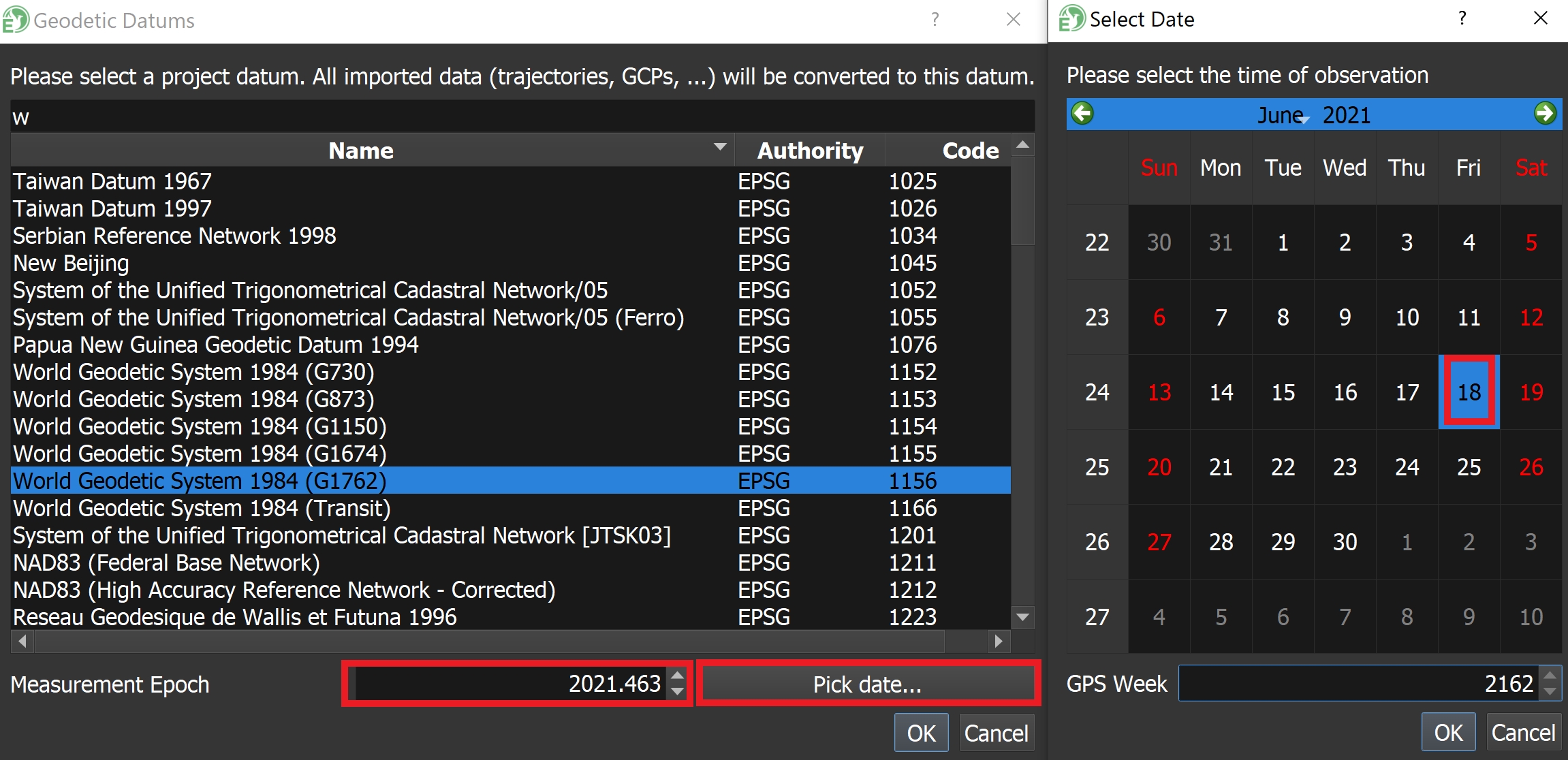
Open the Project PLP in SpatialExplorer, and click on the datum at the upper right to configure the datum as WGS84(G1762) and click "Pick date..." to select the date of the LiDAR acquisition.

GCP Georeferencing
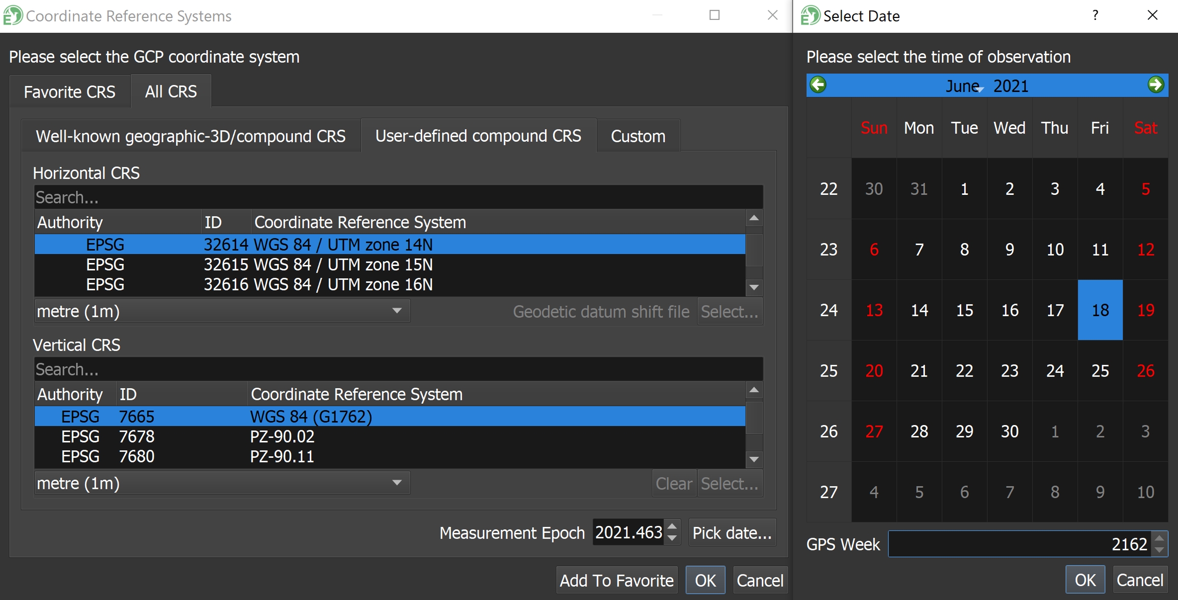
When importing GCPs into Spatial Explorer, Select the Horizontal CRS as "WGS 84 / UTM zone 14N" with units set to "metre" and select the Vertical CRS as "WGS84(G1762)" with units set to "metre".

Reference Station Georeferencing
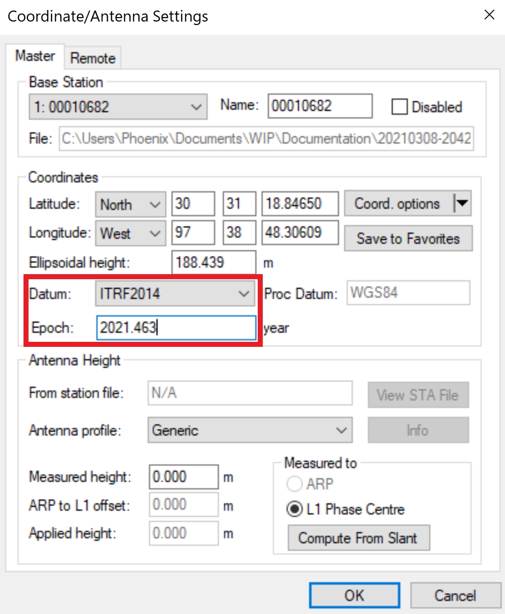
During trajectory processing in Inertial explorer, configure the reference station datum as "ITRF2014" and the epoch as the project datum epoch when the LiDAR data was collected - "2021.463" in this example.
Output Trajectory Georeferencing
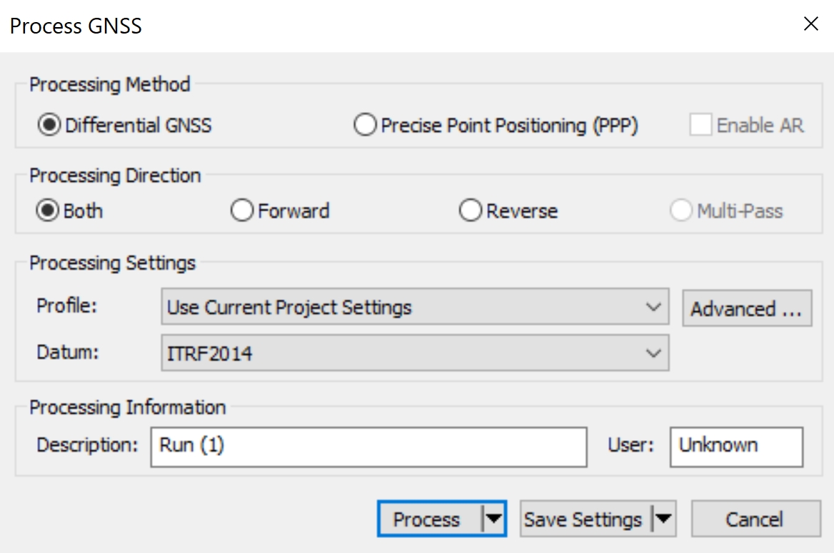
In Inertial Explorer, select the datum "ITRF2014" during the GNSS trajectory processing step
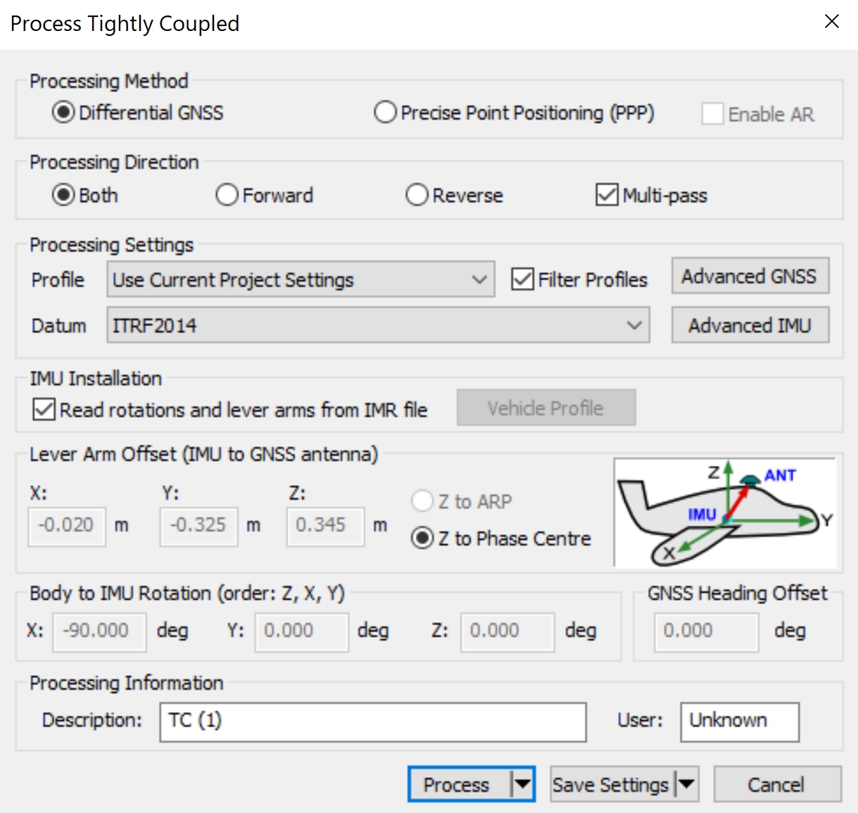
In Inertial Explorer, select the datum "ITRF2014" during the tightly coupled trajectory processing step
Load Post Processed Trajectory into SpatialExplorer
When importing a post processed trajectory into SpatialExplorer, the trajectory epoch will be the same as the project epoch - "2021.463" in this example.

Export Pointcloud Georeferencing
When exporting the final pointcloud, select the Horizontal CRS as "WGS84 / UTM zone 14N" with units set to "metre" and select the Vertical CRS as "WGS84(G1762)" with units set to "metre". Click "Pick date..." to specify the epoch as the date of LiDAR acquisition, and matching the project epoch.
